VillageCoordinates: 31.14° N, 7.92° W
Imlil
إمليلⵉⵎⵍⵉⵍ
Walnut green and snowy stone
See on the mapAt a glance
- Recommended stay
- 1 to 3 days
- Best season
- April to June and September to November (summer for high-altitude treks)
- Elevation
- 1,740 m
- Best for
- High Atlas valley hikes to Armed · Mount Toubkal (4,167 m) ascent · Amazigh walnut-grove villages
- Key landmarks
- Mount Toubkal (4,167 m), North Africa's highest peakToubkal National ParkAroumd (Armed) village and the Mizane ValleySidi Chamharouch shrineToubkal Refuge (3,207 m)Tizi n'Mzik pass to TamsoultKasbah du Toubkal
Mountain village at the foot of Toubkal, about 90 minutes from Marrakech.
Getting there
90-minute grand taxi from Marrakech (Bab Er-Rob) via Asni
Trailhead to the High Atlas & Mount Toubkal
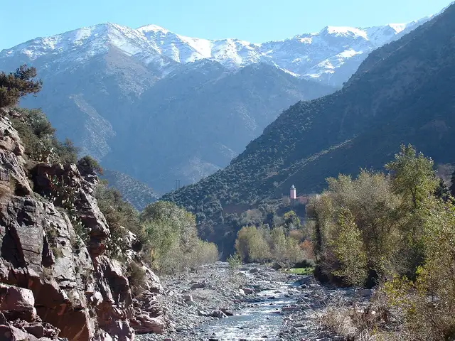
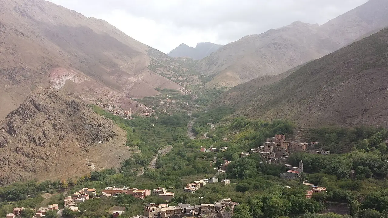
Sitting at 1,740 meters in a lush amphitheater of walnut, apple, and cherry orchards just 90 minutes south of Marrakech, the Amazigh mountain village of Imlil is the gateway to Toubkal National Park and North Africa’s highest peak, Jebel Toubkal (4,167 m). Even if you aren’t summiting Toubkal, Imlil’s cool mountain air and terraced stone hamlets make it the most rewarding day trip or overnight mountain escape from Marrakech.
Gentle Valley Walks & Multi-Day Treks
For a scenic half-day hike, follow the mule trail past bubbling irrigation channels up to the village of Armed (1,900 m) and the Kasbah du Toubkal viewpoint for lunch facing the snow-streaked south cirque. Visitors tackling the two-day Mount Toubkal ascent must hire an official licensed local mountain guide through the Bureau des Guides d’Imlil and spend the night at the Toubkal Refuge (3,207 m).
Weather and climate
Weather now
Live–––
- Feels like
- ––
- Wind
- –
- Humidity
- –
- UV index
- –
- Today's UV peak
- –
Next 12 hours
Climate by month
Average low and highRainy days
| Month | Average low and high | Rainy days | Event |
|---|---|---|---|
| Jan | 0°C – 11°C31°F – 52°F | 5 | — |
| Feb | 0°C – 12°C33°F – 54°F | 7 | — |
| Mar | 2°C – 15°C36°F – 59°F | 9 | — |
| Apr | 5°C – 17°C40°F – 63°F | 8 | — |
| May | 8°C – 21°C46°F – 69°F | 7 | — |
| Jun | 11°C – 25°C52°F – 77°F | 4 | — |
| Jul | 15°C – 29°C59°F – 85°F | 2 | — |
| Aug | 15°C – 29°C59°F – 84°F | 3 | — |
| Sep | 12°C – 24°C53°F – 76°F | 6 | — |
| Oct | 8°C – 20°C47°F – 68°F | 7 | — |
| Nov | 4°C – 15°C38°F – 59°F | 6 | — |
| Dec | 1°C – 12°C34°F – 54°F | 5 | — |
Source: Open-Meteo Historical Weather API (ERA5 reanalysis), 1991-2020 daily averages at 31.13N 7.92W, downscaled to 1,740 m; rain day = 1 mm or more. Updated November 7, 2026. open-meteo.com
Suggested itinerary
Checked by Morocco Insider Tips on November 6, 2026
Day 1 Day 1 — Imlil Walnut Groves, Armed Village & Toubkal Cirque Views
- Morning
- Meet a local mountain guide at the Bureau des Guides d'Imlil (1,740 m) and follow the stone mule paths beside rushing snowmelt streams and terraced walnut and apple orchards.
- Afternoon
- Hike up to the highest village in the valley, Armed (1,900 m), and enjoy a panoramic rooftop tagine lunch at Kasbah du Toubkal or a family guesthouse facing the 4,167-meter south peaks.
- Evening
- Descend via the peaceful pine-shaded trail through Achayn and Mzik villages as shepherd flocks return to the valley at dusk.
Day 2 Day 2 — Tizi Mzik Pass (2,489 m) or Sidi Chamharouch Trail
- Morning
- Set out early up the switchback trail through juniper forest to the Tizi Mzik pass (2,489 m) for sweeping views over both the Imlil Valley and the red-earth Azzaden Valley.
- Afternoon
- Alternatively, hike up the Mizane Valley canyon past small waterfall tea stalls to the whitewashed boulder shrine of Sidi Chamharouch (2,310 m) along the Toubkal ascent trail.
- Evening
- Warm up beside a wood stove at your mountain gîte or return by grand taxi down through Asni to Marrakech.
Tips
- Hiring a licensed mountain guide from the official Bureau des Guides d'Imlil is mandatory for hikes into Toubkal National Park beyond Armed and ensures safety at checkpoints.
- Always carry your physical passport on the trail to Sidi Chamharouch and the Toubkal Refuge for the gendarmerie registration post.
Getting around
- Shared grand taxis to Imlil depart from the Bab Er-Rob taxi rank in Marrakech (south of the Kasbah); a seat costs ~50–60 MAD (sometimes changing in Asni), or charter the whole taxi for 300–350 MAD (90 minutes).
- On Saturdays, allow an extra 20 minutes passing through Asni to see the lively weekly Amazigh mountain market.
Etiquette
- Greet villagers and shepherds along the mountain trails with 'Salam aleikoum' or the Amazigh greeting 'Azul'.
- Carry all plastic bottles back down to Imlil or refill a reusable bottle with purified water at your guesthouse.
Sources, updated November 6, 2026
Getting here by train and bus
Direct rail, high-speed train, and coach routes connecting Imlil.
- Grand TaxiShared grand taxiArriving1h 30m(90 min)30–50 MADSchedule: Leaves when full (6 seats) from near Bab Agnaou or Sidi Mimoun; price is per seatIf there's no direct taxi to Imlil, take one to Asni, which runs far more often, and change there for Imlil.
Nearby
Ourika ValleyأوريكاⵓⵕⵉⴽⴰRiver valley with waterfalls at Setti Fatma, an easy day trip.Village · Half day or full day · 1,500 m
Agafay DesertأكفايⴰⴳⴰⴼⴰⵢStone desert 40 minutes from the city, known for sunset camps.Site · Half day (sunset dinner) or 1 night · 644 m
MarrakechمراكشⵎⵕⵕⴰⴽⵛMedina souks, riads and the square of Jemaa el-Fnaa. Base camp for the High Atlas and the desert.City · 3 days · 465 mUNESCO